The Jumbles reservoir, part of the Jumbles Country Park, lies in the Bradshaw Valley in the Bromley Cross area on the northern outskirts of the town. Details of the reservoir itself are unfortunately very sketchy; at one time a large bleachworks, one of the oldest in the town, was situated in the valley though it ceased trading in 1937 after over 150 years in business. The buildings gradually became derelict and in 1964 the land was purchased by what was then the County Borough of Bolton, to enable the reservoir to be built to guarantee water for the Croal-Irwell river system and its associated industries.
The reservoir was constructed between 1967 and 1970 and was officially opened by the current Queen in March 1971; at the northern end was a large quarry and this and the remains of the bleachworks were flooded during the reservoir’s construction. The remains can now only be seen in times of drought; I can remember about fifteen or so years ago during a long period of hot weather when the reservoir dried up, walking with my partner and our dogs along the very bottom of it – it was strange to think that under normal circumstances we wouldn’t be able to do that. Bradshaw Brook, which flows into the reservoir through the quarry and is normally several feet under water, was little more than a trickle at the time and the remains of the works were clearly visible, sticking up out of the dried-up mud banks. In times of exceptional rain however the water level rises so much that in some places it almost overflows onto the path.
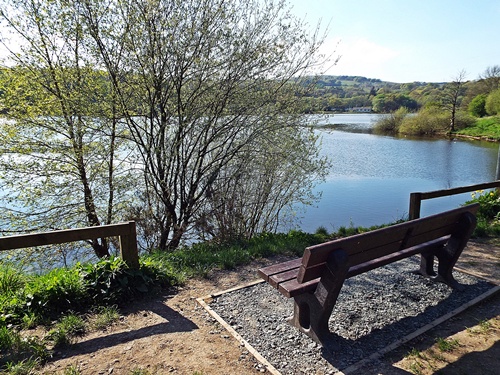
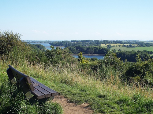
The country park itself is a very popular walking area and is home to many forms of wildlife. A path goes all the way round the reservoir, a distance of just over two miles, and there are car parks on both the east and west sides. My bench is one of a few set near the cafe and information centre close to the car park on the east side; the view looks across the water to the west and takes in a couple of private waterside houses and the clubhouse of the Jumbles Sailing Club with the countryside beyond. It makes a great place to chill out and watch the boats on the water or to rest for a while if walking all the way round from the far car park.
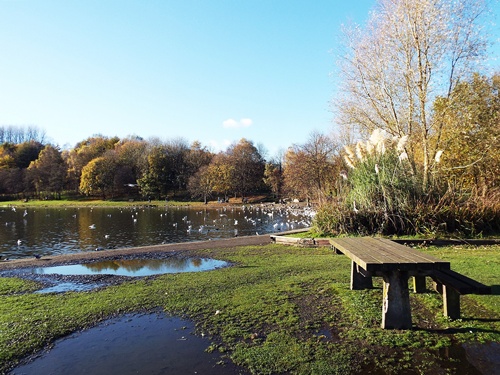
Moses Gate Country Park is a 750 acre site situated just off the A6053 in the Moses Gate area of Bolton, about three miles south of the town centre. The park lies on the Kingfisher Way which runs eleven miles from Clifton County Park to the south as far as the Jumbles reservoir to the north of the town. There are three lakes in the park – one is used for fishing, one for watersports such as canoeing, and the third and largest is a nature reserve for migratory birds and other wildlife. The River Croal runs through the park close to the wildlife lake and over to the east is one of the few sections of the Manchester, Bolton & Bury canal which still contains water.
There are two large free car parks within the park and spaces are also available alongside the grass bank close to the wildlife lake. Children can be kept happy by a good-sized playground with lots of various equipment, each lake has a path all the way round which is great for dog walking. and there are many more paths to explore through the woodland and along the riverside. The place is very popular with local people including joggers, cyclists and dog walkers, but for anyone who doesn’t want to be too energetic then a bench in the sunshine and overlooking the lake with its many swans, geese and ducks is a great place to spend some time.
The Japanese Garden is part of Rivington Terraced Gardens, conceived and financed by soap magnate William Hesketh Lever (Lord Leverhulme) who was co-founder of Lever Brothers, now known as Unilever. Work started in 1905 and continued for twenty years until Lever’s death; the gardens occupy 45 acres of hillside between Rivington Pike and Rivington Hall Barn, and with many woodland paths crisscrossing the site it could easily take several hours to fully explore all the features.
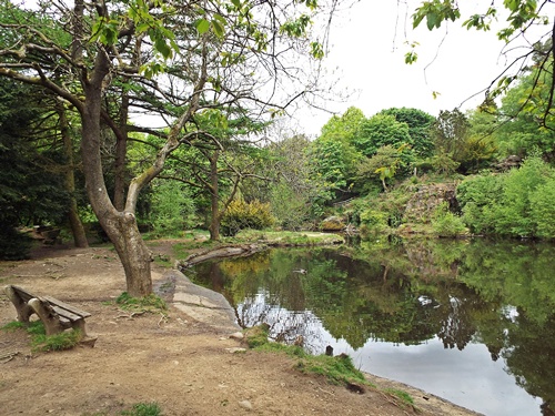
The gardens can be accessed by parking at what is known as the Pigeon Tower car park off the road running from Belmont village to Rivington village; parking is free and there are two paths leading from the car park. The left hand one is very steep and ankle-twistingly rocky though the right hand one makes a much better and more pleasant walk. This path eventually goes under Seven Arch Bridge and keeping straight on will lead to the Japanese Garden. This was inspired by a trip Lever once took to Japan and originally consisted of the lake fed by two waterfalls and surrounded by Japanese tea houses, lanterns and exotic plants; of the original features only the lake and the stone bases of two tea houses remain.
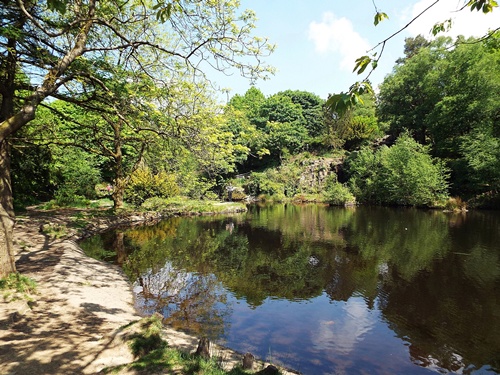
The second photo was taken only a week after the first – unfortunately a family were sitting on the bench the second time so I had to adjust the angle of the shot but it just shows what a difference a bit of sunshine makes. In a quiet spot and with a view like that the bench makes a lovely place to linger while exploring the rest of the terraced gardens.
Anglezarke and Rivington reservoirs from the viewpointSpen Cob, Anglezarke
Anglezarke reservoir is the largest reservoir in the Rivington chain and originally served Liverpool before its current status as a water supply for the Wigan area. It can be reached by road from near Rivington village or a ‘B’ road off the A673 north west of Horwich – turn right at the Millstone pub/restaurant and keep going, following the signs. The road runs past the bottom end of the reservoir and up a steep hill, and where it levels out is Anglezarke Viewpoint, a large lay-by with parking space for several cars and a grassy area with a couple of benches. The first photo was taken looking south from there and shows part of Anglezarke in the foreground with Upper Rivington reservoir in the centre and Lower Rivington reservoir in the distance. Looking north west from there on a very clear day you can see the Fylde coast, Blackpool Tower and The Big One at the pleasure beach.
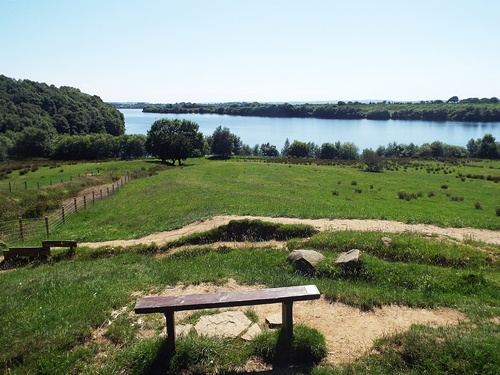
Back down the hill a right turn leads to a dedicated free car park and picnic area, which is commonly thought of as being the start of the Anglezarke trail. There’s a good circular walk right round the reservoir – a distance of about 4.5 miles – through a variation of woods, fields and lanes though the path does veer away from the water on a few occasions. The western side of the reservoir is quite open and has great views across to Rivington Pike and Winter Hill, and about halfway along the eastern side is Spen Cob, where the second photo was taken from. With a bench set back off the path and looking over the field to the water beyond it makes a good turn-round point for a short-ish walk from the car park, or a rest stop if walking all the way round. And for anyone who does walk all the way round then don’t forget to take a drink with you as it’s further than you think – I did my walk on a very hot June day last year and I needed my bottle of water!